Jeju Island
Volcanic island in the south, dominated by Hallasan at 1,950 meters and ringed by the Olle trail. Mild climate, haenyeo divers and three UNESCO sites to explore by car over 3 to 5 days.
Jeju lies 85 kilometers south of the peninsula, separated from the mainland by the Jeju Strait. From Seoul-Gimpo, the flight takes 1 hour 5 minutes and constitutes the world's busiest air route, with departures every 10 minutes during peak season. The island stretches 73 kilometers east to west and 41 kilometers north to south, dominated by Hallasan, a shield volcano rising 1,950 meters at its center. This volcanic geology structures everything: black basaltic soils, underground lava tubes, secondary cones called oreum (more than 360 scattered across the island), and a jagged coastline of hexagonal columnar cliffs like those at Jusangjeolli.
Climate sets Jeju apart from the rest of the country. While Seoul drops to -10°C in January, Jeju hovers around 6°C and mandarin trees continue producing fruit. In August, temperatures reach 27°C with high humidity. This mildness explains the island's agricultural economy: hallabong and cheonhyehyang mandarins, green tea from Seogwipo, omija berries, and a seafood-focused cuisine marked by abalone (jeonbok), grilled black mackerel (galchi) served whole, and Jeju black pork, an endemic breed raised free-range.
The haenyeo culture gives Jeju its most distinctive human face. These breath-hold divers, today mostly aged 60 to 80, descend to 10 meters without tanks to harvest abalone, sea urchins, and seaweed. Inscribed as UNESCO intangible heritage in 2016, they still work from the villages of Hado-ri, Gwideok, and Bukchon. The haenyeo museum in Hado and morning demonstrations at Seongsan allow you to observe them without tourist theatrics.
The island is traversed by the Jeju Olle, a 437-kilometer trail divided into 27 numbered sections following the coast and some interior passages. Each section spans 10 to 20 kilometers and can be completed in a day. Sections No. 6 (Soesokkak toward Seogwipo), No. 7 (southern coast with cliffs), and No. 10 (Hwasun beach and Sanbangsan) rank among the most walked. Inland, Hallasan is climbed via the Seongpanak trail (9.6 km, 4.5 hours uphill) or Gwaneumsa (8.7 km, more demanding), with daily hiker quotas during season.
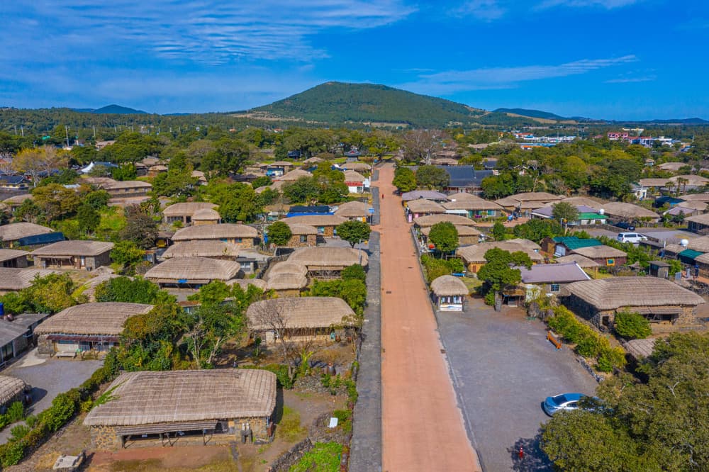
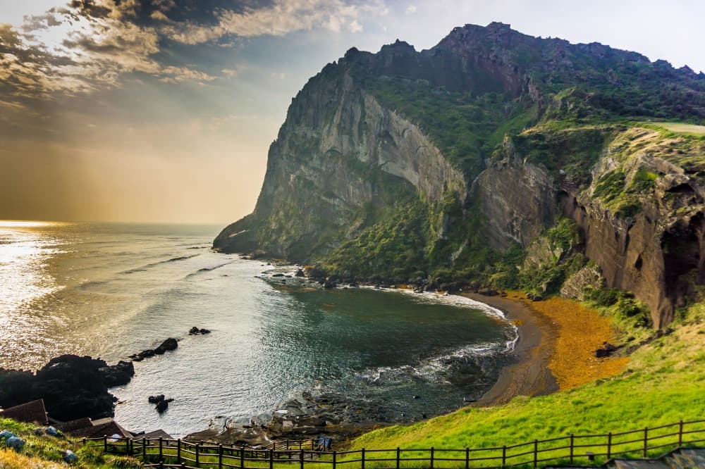
Jeju's UNESCO heritage comprises three geological sites designated in 2007: the Manjanggul lava tube stretching 7.4 kilometers with 1 kilometer open to visitors, Seongsan Ilchulbong peak rising from the sea on the island's east side (a crater formed by submarine eruption 5,000 years ago), and Hallasan itself. Culturally, the Seongeup folk village preserves traditional lava stone houses topped with thatch, and the Gwakji dolmens recall Neolithic settlement.
Our Seoul-based team organizes Jeju stays with car rentals, as public transportation remains limited outside Jeju-si and Seogwipo. Three to four days suffice to circle the island via the coastal road (181 km) while stopping at major sites; five days allow time for a Hallasan ascent and two or three Olle trail sections.
To Discover
Hallasan ascent via Seongpanak. 9.6 kilometers through Korean cedar forests and highland moorland to Baengnokdam crater at 1,950 meters. Allow 4.5 hours up and 3.5 hours down; mandatory departure before 12:30 p.m.
Sunrise at Seongsan Ilchulbong. Tuff volcanic cone rising from the sea at the island's eastern tip. A 25-minute climb by stairs to the crater rim, ideal between 5:30 and 6:30 a.m. depending on season.
Haenyeo divers of Hado-ri. Breath-hold diving demonstrations by village women, followed by a meal of fresh abalone and sea urchin prepared by the cooperative. Active season October to May.
Manjanggul lava tube. One kilometer of underground gallery formed 300,000 years ago, ceiling at 7 meters and a 7.6-meter lava column at the far end. Constant temperature of 11°C; bring a jacket.
Olle trail No. 7 southern coast. 17 kilometers between Oedolgae and Wolpyeong along basaltic cliffs, passing the solitary Oedolgae rock and Beophwan coves. Count on 5 to 6 hours of walking.
When to Visit
The most favorable window extends from April to June and September to early November. Spring brings flowering rapeseed on the slopes of Sanbangsan (mid-March to mid-April) and cherry blossoms along Route 1132, with temperatures between 12 and 20°C. Autumn, especially October, offers stable skies, temperatures around 18°C, and mandarin harvest in Seogwipo orchards. Both seasons suit Hallasan hiking and the Olle trail.
July and August compound three obstacles: the rainy season (changma) until mid-July with 250 to 300 millimeters of precipitation, frequent typhoons in August and September that can ground flights for 24 to 48 hours, and Korean school holiday crowds. Winter remains manageable, with 6 to 8°C at sea level in January, but Hallasan's summit may close due to snow and ice. Note that temperatures drop sharply with elevation: expect -5°C at 1,950 meters when it's 8°C at Jeju-si.
Practical Information
We recommend a minimum of 3 days, ideally 4 or 5. Entry is via Jeju International Airport, served from Seoul-Gimpo (1 hour 5 minutes), Busan (55 minutes), and several Asian cities. Car rental is nearly essential: buses 201 and 202 circle the island but run infrequently with stops far from major sites. An international driving permit is mandatory and must be presented at car pickup.
Jeju combines naturally as a circuit finale, after Seoul and continental South Korea. The most coherent sequence we propose: Seoul (3-4 days), Gyeongsang and Busan (3 days) with a Busan-Jeju flight, then Jeju (3-4 days) and direct return to Seoul. The island suits hikers for Hallasan and the Olle, families for its beaches (Hyeopjae, Gimnyeong) and themed museums, and contemplative travelers who appreciate leisurely drives on secondary roads between basalt fields and dry stone walls. Hotel comfort levels are high, ranging from traditional minbak guesthouses to coastal resorts around Jungmun in the south.