dmz
dmz
Military border between the two Koreas since 1953, the DMZ can be visited from Seoul: JSA, tunnels, observation posts and villages under special status.
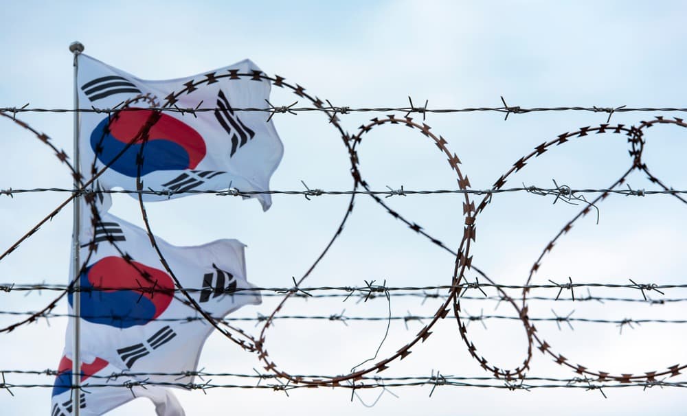
The DMZ (Korean Demilitarized Zone) marks the border between South Korea and North Korea following the armistice of 1953. Stretching 4 kilometers wide and extending 248 kilometers from east to west, it crosses seven towns. Visited each year from Seoul, it serves as both a major historical site and an observation post on the northern neighbor, yet paradoxically has become a pristine natural refuge untouched by human activity for over half a century.
Why visit the DMZ
The DMZ is not an ordinary attraction: it is an active military zone, still governed by the armistice signed in 1953. This underlying tension defines the visit's appeal. You will see infiltration tunnels dug from the north, observation posts overlooking North Korea directly, border villages and, when access permits, the Joint Security Area (JSA), the only point where the two Koreas literally face each other.
The site holds another paradox—an ecological one. The absence of human occupation over several decades has transformed the border strip into a sanctuary for wildlife and flora, observable from certain vantage points.
Historical context
The DMZ emerged from the armistice of July 27, 1953, which suspended fighting in the Korean War without establishing peace. The two states remain technically at war. The JSA, or Panmunjeom, was established that same year on the ruins of the former village bearing the same name. It has hosted rare direct negotiations between the two sides ever since.
Several incidents have marked the zone. The most notorious, the Axe Incident of 1976, saw two American officers killed during a tree-trimming operation; Camp Bonifas, under UN mandate at the JSA entrance, now bears the name of Captain Arthur Bonifas. South Koreans also discovered multiple tunnels dug from the north, material proof of an offensive posture maintained after the armistice.
What to see on-site
Imjingak Park
Located 7 kilometers from the Military Demarcation Line, Imjingak Park serves as an accessible entry point requiring no special authorization. It brings together the Freedom Bridge, commemorative monuments and Korean War military equipment. It is also a memorial space for separated families.
Infiltration tunnels
Four tunnels dug from the north were discovered between 1974 and 1990. Several are open to visitors:
- The Second Tunnel, discovered in 1975 near Cheorwon, measures 3.5 km long and reaches depths of 50 to 160 meters. According to South Korean figures, it could have allowed passage for approximately 30,000 soldiers per hour.
- The Third Tunnel, discovered in 1978, features a section roughly 2 x 2 meters. It ranks among the most accessible from Seoul.
- The Fourth Tunnel, uncovered in 1990, is open to the public for about a hundred meters.
Observation posts
The Dora Observatory, near the third tunnel, overlooks Songaksan Ridge, the city of Gaeseong and Geumgang village on the North Korean side. The Odusan Observatory, at the confluence of the Imjin and Han rivers, allows binocular observation of the northern shore. Further east, the Eulji Observatory opens onto Geumgangsan peaks and the Punch Bowl basin.
The JSA and Panmunjeom
The JSA (Joint Security Area) is the symbolic heart of the DMZ. It houses the blue MAC barracks (Military Armistice Commission), straddling the Demarcation Line, the Panmungak building on the north side and the Peace House and House of Freedom on the south side. To the west, the Bridge of No Return spans the Sachon River. Across from it stands the North Korean village of Kijong-dong, home to one of the world's tallest flagpoles.
Important: tourist access to the JSA is regularly suspended or restricted depending on the security situation. Verify current status with authorized operators before any booking.
Daeseong-dong and Cheorwon
Daeseong-dong is the sole civilian South Korean village living within the DMZ under special status. Further east, the Cheorwon area preserves remnants of the Battle of White Horse Hill, ruins of the Nodongdangsa (former seat of the Workers' Party) and the Seungilgyo Bridge.
Practical information
- Passport required to pass through military checkpoints.
- Guided tour mandatory: the JSA is accessible only through an authorized operator; most other sites are also visited via organized tour.
- Advance booking recommended, with confirmation typically required 24 hours before the visit.
- Strict dress code for the JSA: no shorts, torn jeans, flip-flops, sandals or military-style clothing.
- Photography restricted in several zones; follow guide instructions.
- Access status varies with diplomatic tensions: certain areas, including the JSA, have been closed to tourists multiple times in recent years.
How to get there
The DMZ is reached from Seoul, roughly an hour's drive to the closest sites (Imjingak, third tunnel, Dora Observatory). Since individual access is prohibited in most zones, the simplest option remains a half-day or full-day tour departing the capital, which includes transport, guide and authorizations. Plan a full day to combine Imjingak, a tunnel, an observation post and, if access has reopened, the JSA.
Nearby combinations
Before or after the DMZ, several sites extend the visit on the South Korean side:
- Seoul and its royal palaces, the logical base for journeys to the border.
- Hwaseong Fortress in Suwon, a historical complement south of the capital.
- Hahoe village, another facet of Korean heritage, more rural in character.
Frequently asked questions
Frequently asked questions
To go further
The DMZ logically integrates into an itinerary combining Seoul, the country's historic center and, depending on your interests, a descent toward Busan or traditional villages. To craft a custom trip incorporating this border excursion, explore our South Korea travel ideas.
Interested in this visit?
We can include it in your personalised itinerary.